Pages

Sunday, December 24, 2006

Canal Walk: Sollom to Tarleton to Rufford

I parked at Sollom Lock, there is space for about 7 cars and was lucky to find a space. This lock used to be the link between the canal and the River Douglas before it was moved to Tarleton and the section of river inbetween was added to the canal. Now the lock is there in name alone, the road that crosses Strand Bridge is Lock Lane.

The stone chamber is still there but the gates and paddles have gone. You can see where the gates were fitted, the stonework and metal hinges show where the gates were attatched. The towpath from the Junction at Burscough finishes here and beyond the lock there is nothing more than a grassy track to follow. It is more of a river ramble than a towpath trek as you follow the former River Douglas along behind the tall reeds. This stretch of water has had many names: Lower Douglas Navigation, Leeds Liverpool Canal Rufford Branch, River Douglas, River Alsand. Its about a mile from the old river lock to Bnk Bridge #11. This bridge carries the A565 over both the canal and the tidal river Douglas. Its a very busy road with cars zooming across the quiet canal. Motorists will notice the warehouse next to the bridge inbetween the river and the canal.

From here its another mile to the river lock at Tarleton,but the track deteriorates further and I didnt fancy walking through the undergrowth to follow it.
There was no sign of the milepost which should be near the bridge marking 6 miles to the junction with the mainline. After a bottle of sparkling glucose drink I turned around and headed back to Sollom and then on to look for the milpost four miles from the junction.
The towpath between Sollom and Rufford is in places at the same level as the water in the canal. I was glad of my wellies as I negotiated the planks over the puddles and streams flowing from the canal across the towpath.
There was again no sign of the the four mile milepost so after taking some photos from Spark bridge I turned around and went back to the car.

Monday, December 11, 2006

Canal Walk: Halsall

It was a cold, rainy and windy day, no day for towpath trekking but try telling that to a bored black Labrador. After much excitement we arrived at the canal and parked at the moorings of the Pride of Sefton. With wellies on and the hound straining at the leash we set off Wigan-wards. The towpath alongside the moored boats is very muddy even when it isn’t raining and there is always the smell of a septic tank wafting about. The Ship Inn is on the left as you approach the bridge which shares its name, Ship bridge #22. In the summer the willow and the shoals of small fish make this a very pleasant spot; in December in the rain it is a bit bleak. There is a half mile post here, marking 17.5 miles from Liverpool. The moored boats are on the bankside on the Wigan side of the bridge. Few have people living onboard them. There is half a mile of exposed towpath before we reached Harkers Bridge #23 and Halsall cutting beyond. In the reeds on the bankside was a cruiser that had slipped its mooring and been blown along the cut. The milepost showing 18 miles to Liverpool is near the spot where the Leeds Liverpool canal was started. The first sod was cut here over 300 years ago. This is one of my favourite spots on the canal.
Just past the next bridge, Halsall Hill bridge #24 is a winding hole, a wide bit of canal for boats to turn around in. The bank here has collapsed allowing young dogs to get down to the water and find out that canals are a bit too deep to paddle in. Not only was it still raining but now we had a wet dog shaking herself next to us.
At the next bridge Halsall Warehouse bridge #25 is the Saracens Head. The pub looked warm, dry and inviting as we passed it in the rain. By the bridge is the Halsall Navvy, on his own in the rain today.
We pressed on past milepost 19, past bridge 26 Hulme’s bridge where dog and trekker demonstrated how the grooves on bridges were worn by ropes. The horse’s tow ropes must have been the same thickness as a dogs lead. There was again no sign of the 19.5 mile half milepost, it is hidden in the brambles. How it managed to get onto the 2005 OS map I don’t know.
At Weavers bridge #27 we turned around to walk back this time with the wind and rain on our faces.

Monday, November 27, 2006

Canal Walk: Around and About Appley Bridge

Blue skies over Lancashire today but only a small trek planned. We parked at Appley Bridge #42 in the public car park and set off towards the locks. This is a favourite stretch of canal for me. There are three locks at Appley locks. Boaters had a choice of using one deep lock or two shallower ones. The single lock was put in to save water, something which was a big concern on the Leeds Liverpool during its working life. Today I wanted to visit the two shallower locks which are disused these days.
Pennine Waterway by Gordon Biddle has a photo of the last horse drawn barge leaving Appley Lock in 1960. Anyone who has visited the locks will notice the biggest change since that time; the photograph shows a large house in between the two sets of locks and some houses to the left of the canal. There is no sign at all of these buildings today. Indeed it is hard to image there was enough room for a house on the thin strip of land between the locks and the field to the left looks like any other. There are many sites along the canal where canalside buildings have disappeared without trace, only now visible on old maps and photographs.
The two locks are in a poor state today. The balance beams have rotted and the gates nailed shut. The bridge over to the far side has gone from the upper lock and partially fallen off the lower one.
As we were leaving the locks a barge was approaching to lock up the single deep lock. Feeling like gongoozlers we crossed back to the towpath and walked back to Appley Bridge.
I many of the guidebooks to the canal this area is noted for its large smelly glue factory, today industry is hard to see and the glue factory replaced by a modern housing estate.
There is no sign of milepost 30 but the milestone is there. It is falling very slowly down the embankment, see if you ca spot it just past Appley bridge. We saw a very strange sight a pair of duck with a brood of tiny ducklings. This is late November but obviously the ducks thought it was early spring.
On the way home we stopped off at Parbold to relocate and photograph the 27 mile milepost. This milepost is in a thick hedge and only visible in winter. After a brief search I found it again and cleared the brambles to photograph it. I also moved the barbed wire from the front to the back of it to stop it wearing the post any more and hopefully to stop the post falling backwards down the embankment. If you ever see a man taking photographs of hedges by the canal, it’s probably me and the mileposts. How nice it would be to clear and paint these mileposts before more are lost.

Monday, November 20, 2006

Canal Walk: Burscough to Rufford

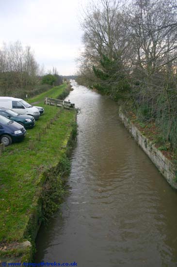
After stops to photograph the Halsall Navvy and to buy sandwiches in Burscough town we arrived at the start of our trek and parked at Ship Inn. The Ship Inn or Blood Tub as it is sometimes known is next to the junction between the Leeds Liverpool mainline and the Rufford branch. The Rufford branch is 7.25miles long linking the main line of the Leeds Liverpool with the River Ribble at Tarleton. I have cycled as far as Marsh Meadow Swing bridge before which was no easy task as the towpath is not maintained in the same way as the main line.
Passing the locks at the top of the branch we soon came to bridge 2A a railway bridge with large passageways either side. Looking up as you pass underneath you will see lots of stalactites hanging down from the stonework above.
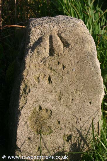
It wasn’t long before we came to the first of the Rufford branch mileposts, the reason for the trek. Albert Cliffe in Towpath Walks mentions the 2 and 3 mile mileposts and I was interested to know if they were still there and if they were the same as the main line posts. The first mile post, one mile from the junction, confirmed they were the same design as the mainline. This one had neither plaque left on it so the second question, what the plaques looked like, remained unanswered for now.
At the intriguingly named Germans lock, number 5 of 8, we came across a BWB maintenance boat and a stoppage. The boat inside the lock had a cargo of brand new lock gates and balance beams, unpainted. The water level above this stoppage was low, in contrast with the canal below it where the towpath is level or lower than the canal waters.
Carrying on we came to another lock with another interesting name, chicken lock, number 6.
The Rufford branch is very river-like while the River Douglas which runs alongside is straight and looks very much like a man made canal. As we came to the railway which completes the trio of transport we found milepost number two. Again this one was without markings or any paint. The railway bridge itself is interesting. The canal and railway form a X and the bridge is skewed across the canal.
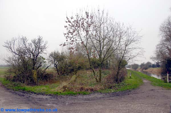
Another mile on and we came to Rufford Lock and the unpromising sign of a large and obviously new wooden fence. In Towpath Walks Albert Cliffe tells how he met a school party having lunch here and showed them a milepost in the hedgerow. The author asks if the reader can find it too. Sadly, the new marina development seems to have robbed this reader of the chance to find the milepost.
There are two marinas below Rufford lock, one on the left the other on the right. The marina on the left, St Mary’s Marina, although full of boats, has only recently been dug out. The mountain of clay still stands next to the water and the buildings are obviously brand new. The marina on the right, the towpath side, has a nice bridge over its entrance. Both these marinas have plenty of narrow boats in them and while we saw a couple of boats on the move on this cold November day I was left mystified where these boats came from and where they go to if they ever do leave their moorings. We turned around here and headed back to Burscough.

On the way back a stone caught my eye, my first thought was that it was a milestone. Closer inspection showed it to have a benchmark on it which reminded me I had seen this on an old OS map simply marked as a stone with a bench mark. With no walls or bridges nearby perhaps the stone is there just to have the benchmark on it, though the nearby milepost does give cause for speculation that it is a milestone.

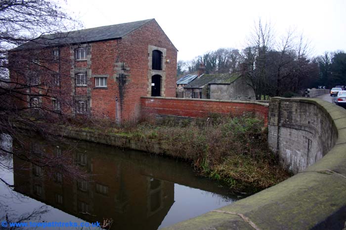
For the second part of the walk we drove to St. Mary’s Marina and parked at their tea rooms. Back at the canal we crossed Chapel bridge and continued towards Tarleton. The canal passes through woods by Rufford Old Hall which can be seen through the trees. The towpath becomes very muddy and is quite tricky to get across in places. After the woods the landscape opens out and the canal passes through flat wide farm land. There was a floating platform at work putting in pilings at the canal edge. Fearns swing bridge is not as impressive as its goal-scoring namesake. There was no sign of milepost 4 in the hedge but milepost 5 was there with one plaque still attached. At Strand bridge #10 the towpath ends.

There is an old lock here with no gates, just a narrow bit of canal. Two stone gate posts mark out an over grown plot as being the likely site of a lock keepers house. From the bridge we could see the canal following the old course of the river to Tarlton and the River Lock. With the sun setting we headed back to the car.

Tuesday, November 07, 2006

Canal Walk: Blackburn to Cherry Tree

After some map reading we found our way to the carpark of the Wharf pub at Eanam Wharf. This was my first time at the canal in Blackburn and I didn’t know what to expect. I was hoping to see some mills and signs of the much talked about regeneration of the canal area.

Eanam Wharf is a group of warehouses similar to those at Wigan Pier. The main warehouse is used by the Wharf pub and a conference centre, with the short covered section of towpath in front of the conference centre closed to walkers.

At midday on a Sunday I had expected the pub to be busy but we were the only car in the car park. We walked around the back of the well redeveloped warehouses to head out of Blackburn to the west.

The towpath is well maintained and would be great for cyclists although the bushes in some places could do with cutting back. Throughout the whole walk the towpath felt very isolated and quiet with only a few people walking on it, and none of the cheery “hello”s of the last walk.

The canal is above the city; past bridge #103 you get a good view down to the main railway station and across to the streets on the hills opposite. Walkers feel elevated on this section. As we arrived at Blackburn Top Lock we met a boat going down the flight. It was a welcome sight to see people using the canal. There are six locks and they, like the towpaths, have been refurbished recently. Lock 54 is squashed beneath a modern bridge, the canal only just given room to exist by the road builders.

The BWB sanitary station is in part of a group of canalside buildings which have been very nicely redeveloped. There is even a sculpture of a man on a bike, suggesting that the smart towpath is aimed at cyclists.

After the locks and just past bridge 98 I found a large milestone hiding behind some brambles. It was in very good condition considering it was made obsolete by the metal posts put in in 1898. After the milestone is Ewood aqueduct dated 1810 and a long embankment from which you can see the home of Blackburn Rovers.

At 55 miles to Liverpool the only milepost of the day was a sad sight. Both its plaques have been lost and the top is missing, filled with rubbish. The disappointing lack of mileposts was made up for by the finding of another milestone. The old 54 miles to Liverpool milestone is, like the 55 mile stone, in good condition.

At Cherry Tree Bridge #95 we reached the start of George Birtill’s legendary Towpath Treks. There are a lot of new houses which won’t have been there when Birtill took to the towpath. There was no sign of milepost 54, and we turned around at Livesey Hall Bridge #94.

We returned to Eanam Wharf to find the pub still empty. The warehouse here is said to have a milepost (57 miles) inside it but the conference centre made it impossible to look for it.

Tuesday, October 31, 2006

Canal Walk: East Marton to Greenberfield

After a filling lunch in the Anchor Inn we climbed about Rocinante again and set off to find East Martin. East Martin is a small place, even smaller than it appears on the map. The road crosses the famous Double Arched Bridge #161, if you turn right at the Cross Keys pub and drive down the small road alongside it you come to some stables next to bridge #162. If you are lucky as we were you will find a space to park on the road, otherwise if you are going in the pubs you can use their car parks. We crossed the bridge and turned to walk back towards Greenberfield.
The Double Arched bridge is one of the most distinctive features of the Leeds Liverpool canal. Opinion is divided as to the reason why it is a double arch. Some think the road has been raised and a second bridge added on top of an earlier one, others say it was built with two arches because the engineers didn’t have confidence in the strength of a single arch. Looking at the bridge I could see no evidence for two stages of building so I would say it was built in one go.
Next to the Double Arched Bridge is milepost 89, over the next 2 miles there are the full set of mileposts: quarter, half, three quarters and full mile posts. In all we found 13 mileposts.
The canal was very still and there were some very clear reflections of the surrounding hills. We passed milepost 88 and arrived at bridge #159 and the furthest point of the mornings walk.
We walked 10 miles altogether and covered 5 miles of towpath. Although there is some light industry and housing there are some very nice views and interesting features on this section. The afternoons walk was a little muddy compared to the tarmaced towpath of the mornings walk. A glance through bridge 162 gave a preview of the next section up towards Gargrave, a tree lined cutting that looked very inviting.

Canal Walk: Salterforth to Greenberfield

We parked Rocinante in the car park by the canal opposite the Anchor Inn by bridge #151. Sancho Panza and I set off in search of a lost canal, a lost flight of locks and as many mileposts as we could find.
A mile down the cut we came to the spot where the Rain Hall Rock Branch joined the main line. The rock cut was a short arm of the main canal which was simply a quarry which boats could enter and be loaded directly from the quarry-face. Limestone was quarried here and was a good source of income for the Leeds & Liverpool Canal Company. When the quarry was closed parts of it were filled in with rubbish. Photographs show that an arch remained next to one of the tunnels on the branch. On the canal the wall by the towpath rises at the point where the branch was. There is a tree-filled gap between a fence and the foundations of a demolished mill which marks the course of the first section of the rock cut. Walking up to Long Ing bridge and turning right we followed a path up the hill. When we were inline with the higher towpath wall we could look downhill along the line of the branch, the path goes over the first tunnel, behind us was a wall with the last remaining section of the quarry beyond. We continued up the path past the farm buildings on the right and along the embankment on the left. Further up the hill the embankment is lower and we could look over it and down a steep slope to the quarry cut. There is still water in the cut but the section is completely overgrown with trees and it was not safe to investigate further. The path turns left and crosses the cut again cross what was the second tunnel. There is no sign of there ever having been a quarry further up the hill, to the right of the path the cut has been completely filled in and grassed over. We retraced our steps and returned to the canal at Long Ing Bridge #153. There is on road parking here.
We continued along the canal. Past Coate’s bridge #154A on the left is the Rolls Royce factory; from the towpath you can see the zigzag roof with its skylights at canal level. A bit further on we found milepost 86 and were passed by a proper Liverpool barge, romantically named “A40”. Barges on the Leeds Liverpool were a development of the Mersey flatboats that were used on the rivers. At 14foot wide they are definitely not narrow boats.
Through Greenberfield Bridge #156 you can see the old canal office building, now a house and BWB station. Greenberfield Top Lock and the start of the canals descent to Leeds from the summit level is next to the house. The locks have a car-park and picnic area. Even the sandwichless visitor should take a diversion into the picnic area to see the old route of the locks marked most distinctly by a bridge in a field with no canal beneath it. On the uphill side of the bridge the ground level is now at road level, on the down hill side there is a drop down to a dry canal. The backgarden of Greenber Field Cottage is the old pound between locks. The old route runs along side the locks to the bottom lock where you can see a reedy stretch of former canal.
At Greenberfield Changeline bridge #158 we met a very friendly horse who posed for photographs with the canal as a background. The canal show its age after this point. In the earlier age of canal building engineers followed contours rather than using the tunnels and embankments of the later stages. This section of canal up to Gargrave has some of the most serpentine twists and bends of any canal I have seen.
Passing milepost 87 we walked up to bridge #159. Before the bridge there are a pair of stone buildings which I guess were for transhipping coal from canal to cart.
We turned around at the bridge and walked back to the Anchor Inn for lunch where we caught up with A40. A40 was one of Rank’s the millers boats carrying grain to Blackburn, before it passed to Henry Crosedale in the 1950’s who supplied Blackburn and Wigan power stations with coal.

Tuesday, October 17, 2006

Canal Walk: Barrowford to Brierfield

As we sped along the M65 we caught glimpses of the canal running alongside and occasionally underneath the motorway. We left the motorway at Junction13 and entered Barrowford. Barrowford is much like the other northern mill towns, with the same rows of stone built terraced houses which once housed the mill workers. Beside the river is the Pendle Heritage Centre, opposite which is a free car park. We parked here and walked up the B6247 to the canal and Barrowford Locks.

The sun was burning up the clouds and the mist was hanging over Barrowford Reservoir. We took at short detour north as far as the lock houses and took the opportunity to have a second look for milepost 80, it is definitely not there. Turning south we passed locks 48 and 49 and went under the 3 bridges which are grouped close together before the next pair of locks50 and 52 (bottom lock).

A little further on is Swinden aqueduct which carries the canal over Colne Water. The canal makes a sharp right turn and walkers are faced with Swinden bridge. Swinden bridge, #142, is a changeline bridge, that means it carries the towpath from one side of the canal to the other in a way that allows a horse to tow a boat without the bridge getting in the way of the rope.

There was no sign of milepost 79 in the overgrown brambles before Hodge Bank Bridge, #141D. Junction 13 of the M65 is very close to the canal at this point but there is surprisingly little sign of this from the towpath. This stretch of canal is different to the previous walk. Although there are views of hills and valleys they are ones covered with terraces streets and mills and factories. It is areas like these that remind walkers that the canal is a man-made structure built during the industrial revolution for industrial reasons and not a natural feature even if its contour hugging curves at times suggest otherwise.

By the time we reached milepost 78 we had seen a number of mills. Although these mills may not be as big as some they are still impressive buildings. Over the next mile we past a number of mills, some empty with broken windows others still in use as warehouses or factories. These mills are in complete contrast to the modern aircraft hanger style of buildings which are now being built along the canal to house light industry. There was no sign of milepost 77 despite it being on the 2005 OS map; brambles again defeated me.

Lob Lane bridge #137 provides access to the canal and is close to a railway station. We were nearing the turning point of our walk. After failing to see a half milepost (76.5miles) I was very surprised to find one of the original milestones. To most passers-by it would look like a lump of stone or concrete but to those in the know it was clearly one of the shaped milestones, this one 76 miles from Liverpool. At Hawks House Bridge #136 we had a snack while a couple of boats passed by heading Leeds-wards.

On the return trip I spotted the elusive 79 mile milepost, hidden by brambles and missing its plaques but painted with the correct mile markings. This brought the total to one milestone, two mileposts, one half mile post and four quarter mile posts.

The bit of canal has been marked out for walkers as part of a heritage trail. Along the way you will notice some curious pieces of art work depicting canal scenes in brick pairs and mosaic tiles.

We returned to the Pendle Heritage Centre which has a very well stocked shop with books about local history and industrial architecture.


The walk totalled seven and half miles and while not the prettiest of walks it is certainly interesting. The towpath is tarmaced for the whole length which is good for cyclists and wheelchairs but a bit hard on the feet for walkers.

Tuesday, October 10, 2006

Canal Walk: Foulridge to Barnoldswick

We parked at the wharf at the north end of Foulridge Tunnel. The area has a few things to interest the industrial archaeologist. First there is the tunnel itself. It is 1640yards long and dead straight. Unfortunately it has no towpath so walkers (and horses) have to take an alternative route. But today we were going north and away from the tunnel. The wharf has a number of stone warehouses, a quarter mile post and a cast iron boundary post which relates to the railway line which until recently crossed the canal at this point. The railway embankments can be seen either side of the canal while the metal rail bridge would have gone over what is now the toilet block.
Leaving the wharf we set off north through the rolling countryside. The canal passes through green farmland for most of this walk. Along the way we found quarter, half and full mileposts. The most picture-esque being the 83miles post which is next to Mill Hill Bridge. there was no sign of the old milestones on this stretch.


The next town on the canal is Salterforth, 84 miles from Liverpool and 43 and a quarter from Leeds (but still in Lancashire). As the canal turns a corner under bridge #151 walkers might notice a post which would have had a roller on it to help stop the tow ropes snagging on the bend. Next to the bridge is the Anchor Inn, a public houses with more to interest a visitor than just beer and spirits. We didnt enter to experience the pub first hand but sat in the picnic area by the canal side car park. Maybe next time we will park here and have time for a pint.


After drinks and sweets we had enough sugar in our systems to walk another mile.
A mile away from Salterforth is the town of Barnoldswick, at bridge 154A. Our visit was one of missed opportunities though. First we couldnt find the 85 mile milepost (or the mill it was once alongside). Without realising it we were at the point where a small branch was cut to quarry rock. I had been keen to see if there was anything remianing of the rock cut, its tunnels, and arched aquaduct but it was only when we had returned home that I saw how close we had been. Looking at the guides there seems to be some debate as to where the border between Lancashire and Yorkshire is. Some guides say that we crossed over and others suggest we were safely on home soil the whole trip. Barnoldswick is in Lancashire but is its canal?
We turned around as the sun was going behind the clouds and headed back. Back at the Foulridge wharf we had a look at the old lime kiln which is in the car park. It was designed so the top had easy access for the canal. It dates back to a time when lime and limestone were the main cargoes on the canal, more important than coal.


This is a very good section for walkers. The car parks at Foulridge and Salterforth are very useful. There were quite a few people out walking or cycling and the towpath is very good. This section also had a few boats on the move, though it is still quiet compared to other canals.

Sunday, October 01, 2006

Canal Walk: Halsall

Today was more of a towpath toddle than a trek. With my trusty yet tubby retriever in tow we set off for a short walk. We parked at near the Sarcens Head pub, near bridge #25 Halsall Warehouse bridge. In the carpark by the bridge are two new pieces of sculpture. the first and most noticeable is the figure of a man emerging from the ground. He is naked with a shovel to hide his embarrasment. The other is a large piece of rock with a fish carved on it which doesn't look finished. I will have to return to see what it looks like when completed.


the weather was nice and we werent the only ones out for a walk by the canal. We headed towards the cutting, though my companion had started to pant not far after the pub. We made it to the next bridge Halsall Hill bridge #24 with some dragging and encouragement. I took photos of a boat passing under the bridge as my canine companion had a sit down to get her breath back.


Break over we headed back to the car. The hedgerow was in full fruit and autumn was in evidence across the fields. Soon the hedges will have died down and the mileposts will come out of hiding ready for the winter season of milepost hunting.

The sculpture is very impressive and its nice to find such artwork in a carpark by the canal. I hope there are other works of art being put along this stretch of canal. They would certainly add to the towpaths.

Monday, September 25, 2006

Canal Walk: Liverpool

Its been a while since I last treked on the Leeds Liverpool towpath so it was nice to have even this short walk at the Liverpool end. Parking the car on the dock road we walked through the Heritage Market (a large market selling fake dvds and cheap clothes) in the old warehouses of Stanely Dock and the old tabacco warehouse. We crossed Great Howard Street and went throught he unobrusive doorway to the Liverpool Locks.
If you should ever visit the locks compare the flora and fauna of the canal below the bottom lock to that of the pounds higher up. In the dock and canal below the bottom lock you will see mussels on the stonework and seaweed growing from the locks. If you visit at the right time of year you may see swarms of jelly fish floating about in the canal. And yet above the lock the crystal clear waters are home to large forrests of freshwater weed and fish.

We walked up the Stanley Dock arm to the main line and turned left (away from Liverpool). The area was deserted apart from a couple of Canada geese. The signature blue cast iron bridges of the Liverpool canal stretched out before us.
As we walked along I solved the mystery of the milepost mentioned in the Aerofilms Guide to the Leeds Liverpool canal. The guide mentions a milepost stating it is 127 miles to Leeds, but by my reckoning the original 127 mile to Leeds post would now be in someones back garden in the section of canal that was filled in in the 1980s. Whats more it would have been a 127.25 mile post as the measurements started at Liverpool rather than Leeds. I found the milepost, it was obviously one put in when the canal was refurbished in the recent past. Whoever sited it there knew that the canal was 127.25 miles long so put the 127mile marker 0.25 miles from the end of the canal at Eldonian village ignoring the 0.25miles of canal beyond there now filled in. The result is that the marker is too far away from Liverpool.

We carried on to Boundary lane and left the canal at the bridge to walk down to the Chinese upermarket.

Saturday, September 23, 2006

A Shropshire Sail

The sky looked unconvinced as is often in England in September, it could have been a hot sunny day or a chilly rainy one. We climbed aboard at Nantwich Basin and set off towards the Barbridge Inn at Barbridge Junction.
At Nantwich basin there is the interesting Nantwich Junction Bridge which is a changeline bridgetaking the towpath from the canal to the basin. The canal passes through Englands green and pleasant land of rolling green fields with dairy cows and oak trees. We soon reached Hurleston Junction and looking right we could see the Hurleston locks and the start of the LLangollen Canal. Not much further on but before the next junction is the Barbridge Inn formerlly the Kings Arms Inn. As luck would have it a boat was leaving as we arrived and we managed to moor up right outside the pub.
After the meal we turned around at the junctiona nd headed back to Nantwich. On the way we spotted a kingfisher on a branch before it became a blue streak, flying up the canal.
There had been no sign of mileposts all day until leaving the basin in the car I noticed on by the bridge in the basin.

Tuesday, August 08, 2006

Liverpool Dock Walk II

After hearing about the test digs for the canal dock link I went to see if there was any evidence of building work. The holes of the test dig have been filled in now. North of Princes Dock work is being done to prepare for the new lock from the Princes half tide dock to the River Mersey.


This photo (above) shows the earth dams and drainage in preparation for the new lock.


The orange sand in this photo could be from the channel being cut through the infilled dock to the north.
the whole project was at one time proposed to be completed by spring 2007. Doesn't look like it will be. Hopefully work will start before the end of this year.

Photos of the canal under construction. 

Saturday, June 24, 2006

Canal News

The future is a slow boat to Bootle
Jun 21 2006

The Leeds and Liverpool Canal is one of our city's most neglected assets. Now there are plans to change that with boat trips for tourists and shoppers.
[The] idea is for a canal boat to carry shoppers the four miles from Vauxhall in the heart of old Liverpool to the Strand shopping centre, Bootle. It is a modest enough start, but his ambition stretches into the future.
A £20m British Waterways project is already under way to extend the canal from the Stanley Dock to the Albert Dock with a cut across the Pier Head. It is hoped that it will be completed by 2008 when, as the whole world knows, Liverpool will be the European Capital of Culture.
This could be the opportunity for the city to benefit from one of its most neglected assets, as the boats would pass by the old Scotland Road area.

full story

This is a very good idea. It will bring people to a very quiet stretch of canal as well as providing training and jobs for young offenders. It is a shame that the canal was filled in between Pall Mall and Eldonian villiage as a link between Bootle and Liverpool would have been useful, with stops at Stanely Dock, Vauxhall and Litherland. Obviously there is the dock link but that link will have locks and wont be as direct as Pall Mall was. I look forward to taking a trip on this section of the Leeds Liverpool in the future.

Sunday, June 04, 2006

Canal Walk: Barrowford to Foulridge

After a evening of popping blisters, sticking plasters and pouring on aftersun I was ready for another walk. A breakfast of one jam doughnut was more than enough for the six mile round trip from Barrowford to Foulridge. I parked at the Pendle Heritage Centre in Barrowford and walked up Colne Road to the canal at Barrowford Locks. At the canal I turned left where there are three bridges in close succession (#142A, #143, #143A) and walked north towards Fowlridge Tunnel. Barrowford Reservoir is alongside the canal between locks 49 and 45.

There was no sign of the 80 mile milepost but by the lock side buildings at the Top Lock there was a quarter mile post and then a 3/4 post past Blakey Bridge #144. After Wanless Bridge #145 there was a very well preserved mile post showing 46.25 miles to Leeds and 81 miles to Liverpool, 60 miles away from yesterdays walk.


We arrived at the western entrance to Foulridge Tunnel just as a boat was exiting from the dark. With the plasters holding the blisters in check we followed the towpath diversion across the top of the tunnel, alongside the Fowlridge Lower Reservoir, through Fowlridge to Fowlridge Wharf. Fowlridge Lower Reservoir doesnt have the man made look of the smaller Barrowford Reservoir. It looks like a scene from the Lake District and was a nice change from the thin strip of water I have become used to.
Foulridge or Foal Ridge is a mixture of 1960s suburbia and original housing from its days as a cotton weaving town. Unfortuantely the Hole in the Wall pub is closed so I didn't have chance to see the famous photograph of the cow that swam the length of the tunnel.

Foulridge Wharf is a sad sight, the buildings are disused and up for auction and there is nothing there for tourists apart from a canal trip boat which didn't look like it was open for business. Again timing was right and a boat was entering the tunnel in time to have its picture taken.

A tiny newsagent was the only place we found for any refreshment so we headed back with out much delay. The return trip didnt seem to take as long but my feet began to complain. On the way back past the reservoir the yacht club were out sailing about in the sunshine. Capsizing looked a good way to cool off. I am sure I will return here to continue my towpath trek. Driving along the M65 motorists can glimpse the canal beneath which was once the high speed transport of its day.

Saturday, June 03, 2006

Canal Walk: Wigan - Scarisbrick 13.5 miles

Its a gloriously sunny day so a longer walk than usual was called for; 10 miles from Wigan Pier to Burscough Bridge. The train from Southport to Wigan follows the canal and crosses it more than once. It was while looking at the canal I noticed that the towpath at Appley Bridge was still closed to walkers. Not a good start to the day but the stoppage would be three miles into the walk so I carried on as planned.
Turning right out of Wigan Wallgate it is a short walk down hill to the old terminus of the Leeds Liverpool at Wigan Pier. The original 1770 warehouses are still there, now hemmed in by two very busy roads. The area around the pier is being redeveloped so I walked up to Wigan Bottom Lock (#87) to see if I could see any progress. Trencherfield mill has scaffolding on it and is now closed to visitors. There was a boat approaching the lock, the first of many boats enjoying the sunshine. I turned around at the lock and headed back to the pier. The museum is now closed and the area quiet once more. Near the pier is a milepost marked as 34 miles to Liverpool. The plaques are replacements and the location is wrong, this post is 34.5miles from Liverpool and should be a half mile post.
Leaving Wigan by canal the view is dominated by the JJB Stadium on the left and a large basin on the right. The hedges are now fully grown and the mileposts I found over winter have disappeared again like Brigadoon until autumn. I had a brief stop by the disused Crooke lock to feed a horse and put a plaster on my bleeding toe. The woods around Crooke and Gathurst were perfect for such a warm day providing shade and a beautiful leafy backdrop to the canal.
At Dean Locks the signs warned of the towpath closure and the lack of diversion. So I went onto the island between the duel locks and had my lunch. There were quite a few cyclists who went past only to turn reappear once they had been foiled by the closure.
As I ate a boat was descending the lock, I thought about asking for a lift past the closed towpath but not wanting to hurry my food I decided to head back to Gathurst and find the station.
The journey from Gathurst to Appley bridge on the other side of the closed path takes 4 minutes at most and costs £1, had I got on the second carriage I could have avoided paying but the inspector had just enough time to sell me a ticket before I had to get off.

I had missed about a mile of towpath by taking the train but it was all part of the adventure.
Leaving Appley Bridge I passed the 3 Appley locks, one deep and two shallow and the site of my childhood stickleback fishing days.
Next stop was Parbold where I had a sit down and a drink to let my feet have a break. Not long after Parbold I began to feel a bit weary so when I reached the junction with the Rufford Branch I stopped for another break and to use the BWB facilities.Afterr somesurreall heckling from children I pressed ontowards Burscough bridge. My break by the top lock had recharged my batteries so instead of catching a train at Burscough Bridge station I passed through Burscough and walked on to Heatons Bridge (#28) 3 miles further on. Here I stopped and had a well earned pint and a welcomed burger and chips. I had traveled about 13.5 miles and due to my boots being 2 sizes too small got a couple of blisters.
I recommend this walk, the Southport to Wigan line follows the canal from Burscough Bridge to Wigan and is useful for getting to and from walks. I saw the more boats on the move today than I have for a long time, but still the canal is quiet in comparison to other navigations. If my feet let me I have another walk planned for tomorrow...

Wednesday, May 31, 2006

Canal Walk: Haskayne

Today I had a 4 and a half hour "lunch break" so I went to Haskayne to eat my lunch and have a walk. I parked by the Pride of Sefton's moorings and after my ham salad bagette set off for a short wander towards Liverpool. Approaching the Scarisbrick Arms the Pride of Sefton came through the bridge on its way back home. I walked up to the winding hole near the 17 mile milepost and turned around just before the swing bridge. There were lots of ducks and ducklings about enjoying the sunshine and some baby coots and moorhens that could only be loved by their mothers, not pretty things. Plans are afoot for a bigger walk this Saturday and a new stretch of canal on Sunday.

Wednesday, May 10, 2006

Liverpool Dock Walk

Today I went for a walk along the river front in Liverpool. There is a lot of building work going on in Liverpool ahead of the city being the Capital of Culture in 2008. I went looking for any signs of the proposed canal-dock link which will allow boats to enter the docks at Stanley Dock and pass through the other docks up to Albert Dock. There was work going on around Princes Dock and Georges Dock area but nothing that looked like a canal being built. Still it was a hot sunny day and where better to be than by the Mersey? ("in a pub" is the answer). Not far away from Princes Dock is Old Hall Street the former and original terminus of the Leeds Liverpool Canal, now only one building of a coopers yard remains of the old basin. It will be nice to see boats coming from the canal to the docks if the link is built. I dont think it will make the Liverpool end of the canal busy but the number of boats using the Liverpool end each year can be counted on your fingers so anything is an improvement.

Sunday, May 07, 2006

Canal Walk: Halsall

We started at Bridge #25 and walked to milepost 17 just after Haskayne Bridge #21A, about 3 miles round trip. The main feature of this walk is the cutting between Bridges 23 and 22. Halsall Cutting is where the first sod of the Leeds & Liverpool canal was cut back in the 18th century. Spring has definitely sprung and the towpaths are green again, the cutting is getting back to looking like an arboreal secret canyon and the ducks have tiny ducklings with them. The Spring feeling was briefly spoilt by the usual stench of sewage by the Ship Inn (nr bridge #22). On the return trip we saw a retriever and a spaniel enjoying a swim in the cut, the two happiest canal users on the whole 127.25miles. Further along the cutting there was a couple in a kayak, one of the best ways to enjoy the canal especially Halsall Cutting.

Saturday, May 06, 2006

Canal Books

In the last week I have bought so many books about canals I have lost track of how many and which ones I have ordered. There dont seem to be any new books which cover the Leeds Liverpool and the most recent ones do not cover the whole 127.25 miles of it. This is the reason for my website guide to the L-L canal. Anyway here are the ones I have got so far:

Towpaths of England by Brian Bearshaw 1985
I only got this one today and have just reading the start and end of the chapter on the L-L and it was depressing! Not only was the Liverpool end in a terrible state when the author visited the canal but he describes seeing a drowning dog and he ends his chapter with the sounds of the dog still barking, he didnt even get it out of the canal! Thatchers Britain was an evil place! He does speak highly of the Leeds end but as usual the from Burscough onwards is covered very briefly.

Canal Walks Vol.1:North Dennis Needham 1994
A very descriptive little book with maps and transport details you need for walking on our canals. Although now 12 years old it is probably the newest book I have other than my Nicholsons Guide. I will hopefully get to do some of the walks fromt his book this summer.

SlowBoat Through Pennine Waters frederic Doerflinger 1971
Said to be a classic book about northern canals. the authors boat breaks down at Johnsons Hillock, and it doesnt look like he made it to Liverpool.

Discovering Canals in Britain Peter L.Smith 1981
A small guide to canals, their history, architecture, engineering and places to visit. nearest thing to an I-Spy Guide I could find!

Landscape with Canals L.T.Rolt 1977
A memoir of the authors time living on the canal in his barge Cressy between 1939 and 1950. this one came from our stores so I got it for free. Hard to believe what a poor state the canals were in in the 1940s.

Walking Britain's Rivers and Canals 1997
A big glossy book of walks, unfortunately it doesnt include the Leeds Liverpool canal at all! A bit big for taking out with you, its not exactly pocket sized but a nice book all the same.

Sunday, April 30, 2006

Canal Walk: Chorley

The rain and drizzle managed to hold off long enough for todays towpath trek. We parked at Botany Bay by the half mile post marking 46.5 miles to Liverpool. We have walked north from here up to Johnsons Hillock before so today we went south as far as Rawlinsons Bridge #71 at the 43 mile mark. A 7 mile round trip was about right given the grey weather.

We spotted the 46.25mile quarter mile post but there was no sign of the 46 mile milepost, it probably went when the motorway was put in.

All along this walk we were never far from the motorways or busy main roads. There were signs of past industry but only one remaining mill. Some places were residential with gardens backing onto the canal. The towpath was popular with cyclists (who had left their manners at home), fishermen and walkers. We saw 5 boats on the move (one of which was going backwards). There were no swans at bridge 77A Froon Street so there was no need to tighten my grip on my walking stick as George Birtill felt he had to on his trek.

Milepost 45 was missing but the half mile (44.5 miles) was there. After Barrack Bridge #75 the area around the canal was wooded and there was less sign of industry. We found milepost 44 which needs a coat of paint.

This section is part of Rennies Lancaster Canal South part so the bridges are his impressive monuments. Bridge 74A is perhaps the most impressive, it is both skewed and twisted over the canal with deep rope cuts and stalagmites. The aqueduct near Cross Hall Bridge #76 is a great work of engineering and design but one few people must see as the view from the aqeduct is as George Birtill said in 1973 one of "one mill in ruins and the yard full of industrial paraphenalia". This river is Black Brook the source of Chorley's industrial power.

43.75 miles quartermile post was spotted as we headed towards the end of our trek. Bewteen Idle Bridge #72 and Rawlinson Bridge #71 there are the remains of a embankment where a mineral railway crossed the canal from the Ellerbeck Colliery.

Mile post 43 is not shown on any map, and is now missing, but under Rawlinson Bridge you can see the milepost shaped mark of where it once was. A sort of trace fossil of the milepost world.

It was too wet to sit on the bench opposite the boatyard so we just turned around and started back. The highlight of the return trip was a big pig in a pen next to the canal.

I doubt I will do this walk again, the towpath was good in places for cyclists but the views cannot compare with the sections either side of this stretch.

Friday, April 28, 2006

Canal Walk: Riley Green to Withnell Fold

We drove from Liverpool and parked at the Boatyard Inn just off junction 3 of the M65, right by Riley Green Bridge #91A. The pub is on the bankside; to get the towpath you pass an attractive ruin. We doubled back under the bridge and walked south west (towards Wigan/Liverpool).

Milepost 51 once was next to this bridge but is no longer there. Not far from the M65 (Brimmicroft Bridge 91AA) we found the 50 mile milestone. As suggested by the 19th century OS maps the milestone had a benchmark carved on to the top. There was no sign of any mile markings though. The milestones on this section are made of a better quality sandstone than their counterparts on the Wigan to Liverpool section.

The three Ollerton Bridges (#91, #90 and #89) as mentioned by George Birtill in his 1970s book Towpath Trek are very picturesque but seemingly overkill as they do not link anything other than fields. The bridges are of the same sturdy build as the bridges on the Lancaster Canal southern part, which was later, incorporated into the Leeds Liverpool canal.

Anyone looking for mileposts and milestones will notice that on this section the mileposts have been painted and have daffodils planted beside them. We found the 50mile milepost and the quarters and half posts associated with it. The first time I have found a mile, quarter, half mile and three quarter mile post in succession.

Withnell Fold was once a centre for paper mills. The former sludge ponds and filter beds are now a nature reserve and an ideal place to stop off for a picnic. They can be reached from Withnell Fold bridge #88 or by climbing over the wall alongside them.

We found the 49-mile milestone which also had a benchmark carved on it. From there it was a short distance to Jacksons bridge #87 (formerly Stony Flat Bridge) and its twin Brown House bridge #86. These bridges are another example of the engineering and architecture of the 19th century. The canal runs along a contour on a steep slope; therefore the bridge has to be at an angle from the towpath side to the bankside.


We soon found milepost 49 which had eluded us on a previous walk from Botany Bay. It was behind a fence and in some brambles it is completely hidden when the hedge is in full leaf.

Having reached the extent of the walk from Botany Bay we turned around and headed back. We took a diversion at bridge #87 to take a closer look at an aqueduct visible from the canal towpath. I assumed it was a railway viaduct but looking at the maps it seems to be just a very impressive way of bridging a small valley.

We went back to the towpath and returned to the Boatyard Inn passing many cyclists and walkers but only one boat on the move.

As we had used the pubs carpark and they had taken the time to put up signs about £100 fines and clamps we thought it was only fair to have a pub lunch. The Boatyard is a modern pub with a good menu, a nice terrace and overnight mooring for customers. It is an ideal place to start or end a day enjoying the canal.

Feeling refreshed and relieved we decided we would have a short walk in the other direction, towards Blackburn. We found milestone 51 and just beyond Finnington bridge #91B an impressive stone wall which used to belong to a Small Pox hospital. The moorers didn’t seem to be concerned that their boats were just feet away from a building that was once home to victims of the pox. After Millfield bridge #92 we found milepost 52 which only had the “75 1/4” left of its Leeds plaque and little more of the Liverpool one. It had been painted and had some canalside daffodils to mark it.

Before Stanworth bridge #93 there are the remains of a quayside and tramway which ran from the paper mill at Feniscowles. There is also a distinctive winding hole which looks like it was once a small arm serving some industry but there hasn’t been anything on the site for the last 150 years.

The paper mill at Fensicolwes keep their privacy with a tall ugly concrete wall which is sited in front of the original stone wall. This Berlin wall has hidden the 52-mile milestone from view. As the M65 came into view beyond the trees and the canal passed over a stream we come to a boundary marker on the border of Chorley and Blackburn and Darwin. We turned around here and went home.
This was one of the nicest and most interesting walks we have done. The abundance of mile markers and the aqueduct added to the landscape views and cute lambs and sheep.

Canal Walk: Burscough

A very short (two mile) walk today but one with a couple of surprises. I parked on the road by the canal at Burscough bridge (32A) and walked west. It had been sunny in the morning but was looking a bit grey by the time I got to the towpath in the afternoon. The first interesting thing I saw were several shiny metallic disks, very X-Files.

I have no idea what they are though...
As I strolled along my second surprise was a half mile post. I hadn't expect to see one there and wasnt particularly looking for it, but there it was. It marks 23.5 miles to Liverpool. Its in good condition but needs a coat of paint; which is more than can be said for my third surprise of the walk...
As I was approaching Crabtree Swing Bridge (#32) by the Slipway pub a couple of boats were passing through. While it is surprising to see boats on the move on this stretch it was not as surprising as seeing a milepost (Liverpool 23 Miles, Leeds 104.25 Miles) that I had looked for on more than one occasion. In fact last time I visited I had a good look, had a OS map from 2005 showing where it should be and took a photo of where I thought it would have been. There was no sign of it at all. Yet with the brambles died down I noticed a very falorn milepost halfway down the side of the embankment. It had brambles over it, a chunk missing from the top, no paint and is in a precarious position. I couldnt reach it but managed to move the brambles enough for a photo.
Happy with my find I turned around at New Lane Swing Bridge (#23) opposite the Farmers Arms and headed back to Burscough to watch the local team play Marine. Marine beat Burscough by 3 goals to nil. I recommend a bit of nonleague football to any boaters passing through.

Canal Walk: Scarisbrick

Another sunny day, it must be a record! Just a small walk to stretch the legs today. I parked at the former wharf by Hulmes Bridge (#26). Again no sign of the half mile post near Weaver's Bridge (27) but there were boats on the move today; one barge, one narrorboat, one cabin cruiser, an inflatable dingy and an inflatable kayak. I walked as far as the next half mile post by the stop lock at Such Hey Wood and then back to Scarisbrick bridge.

Just along the road from the canal is a medieval stone cross. It was once part of two lines of crosses from Scarisbrick Park to Ormskirk and Burscough Priory. Its not much to look at but it is one of the oldest monuments in this area.

Walking back I stepped down into the field alongside the towpath. These fields were fertilised with the waste of Liverpool, brought up by boat from the city. As a result the fields are full of fragments of pottery, glass, stone and metal. No sign of the clay pipes like the ones I have found before but I did find a metal hook and lots of decorated pottery, willow pattern was common. Easy pickings for the (very) amatuer archaeologist.

Photos

Canal Walk: Gathurst and Crooke

I had a hangover and some fresh air and sunshine by the canal was the solution. I was going to park at Appley Bridge (#42) and walk up to Crooke but arriving at Appley bridge I found the towpath was closed between Appley Bridge and Ranicars swing bridge(#44). Instead I parked at the Navigation by Gathurst bridge (#46) and walked from there to Crooke bridge (#47). On the way I looked for the 32 mile milestone by the River Douglas but had no luck. There were quite a few people out enjoying the sunshine. I walked up to Crooke and had a look for the 32 miles milepost but if it is there it is hiding very successfully. I turned around and went back to the Navigation and then under Gathurst bridge and down to Dean locks. No sign of the half mile post that is shown on the 2005 OS map but there was a cat sat on the reeds watching ducks. I walked past the dual locks and the former junction with the River Douglas.
Armed with my OS map I managed to find the 31miles milepost, one I have looked for on a few occasions. It was hidden by brambles and not easy to photo. In the trees on the bankside I could here a woodpecker pecking wood. It was just a short walk, only 4 miles, but it did the trick with the hangover.

Canal Walk: Heatons Bridge

This afternoon it was sunny enough to be tempted out to the towpath at Heatons bridge (28). I was looking for some mile stones, today it was 21 and 22. The car park at Heatons bridge was full, a popular pub for a Sunday drink. Walking north to Martin Lane bridge (29) I passed a couple of people on bikes and some dog walkers. The field boundaires were the same as the 1894 OS map but there was no sign of milestone 22. I turned around and walked a mile in the other direction to look for milestone 21. On the way I passed milepost 21 and quite a few mallards sat sunning themselves on the side of the canal. Unfortunately again I was unable to find the milestone even though I could be confident of standing in the right place. Although its only early April it was too warm for my fleece so I turned around again and went back to the car.
On the way home I stopped off at Hulmes bridge (26) to look for the half mile post (19.5miles). I walked south up to Halsall Warehouse Bridge (25) passing milepost 19 then turned around to walk back past Hulmes bridge and on to Weavers bridge (27). There were a few people fishing and Vagabond from Riley Green was heading back north. No sign of the half mile post in the brambles, soon the hedge will be green again and I will have to wait until autumn to look for it again.
No luck with the milestones and mile post spotting but a nice short sunny walk on a day that was predicted to be rain and sleet!